Top 10 US Regions Most at Risk From El Nino Extremes, Plus Preparation Steps
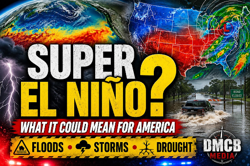
El Nino is a recurring warming of the central and eastern tropical Pacific Ocean that shifts the jet stream and changes where storms, heat, and drought tend to concentrate. It does not “cause” a single storm, but it can tilt the odds toward certain patterns for weeks to months at a time. Those shifted odds matter, because they can stack on top of already vulnerable conditions like saturated soils, depleted reservoirs, fragile coastlines, or a dry landscape primed to burn.
This guide from “Search. Support. Truth.” ranks the Top 10 US regions most at risk from El Nino extremes and provides practical preparation steps for households, businesses, and communities. “Most at risk” here means a combination of (1) how strongly El Nino typically nudges seasonal temperature and precipitation, (2) how often those nudges translate into damaging extremes such as floods, landslides, coastal erosion, drought, heat, or severe storms, and (3) how exposed the region is because of population, infrastructure, water systems, agriculture, and wildfire fuels.
Important reality check: El Nino impacts are probabilistic, not guaranteed. Local weather can still swing the other way for days or even an entire season. Use this article as a preparedness framework, then follow official forecasts and local emergency management guidance.
How to use this article: If you live in one of the regions below, read your region’s “What to watch” list and then follow the preparation steps. Even if you are outside the top 10, the general preparation playbook near the end will make you more resilient to any seasonal extreme.
What “El Nino extremes” can look like in the US
- Flooding and flash flooding from repeated storm tracks, atmospheric rivers, or slow moving frontal systems.
- Landslides and debris flows on steep terrain, especially after wildfire burns.
- Coastal erosion and coastal flooding from storm surge, large surf, and high tides.
- Drought and low snowpack where the storm track shifts away.
- Wildfire risk changes, sometimes during the same year, for example wet growth followed by drying, or persistent drought.
- Severe thunderstorms and tornado outbreaks, particularly in parts of the South in certain setups.
- Warmer winters that affect snowpack, pests, energy demand, and public health.
Top 10 US Regions Most at Risk From El Nino Extremes
1. Southern California, coastal counties and inland valleys
Why it is high risk: Southern California often sits near the southern storm track during El Nino winters. That can increase the odds of repeated Pacific storms and atmospheric rivers. The region’s risks are amplified by steep terrain, extensive development in floodplains and canyons, and the frequent overlap with burn scars that can fail suddenly in heavy rain.
What to watch in El Nino conditions
- Short duration, high intensity rainfall that overwhelms storm drains and washes out roads.
- Debris flows in and below recent wildfire burn areas, sometimes triggered by a single downpour.
- Coastal erosion, cliff failures, and flooding in low lying beach communities.
- Reservoir rule changes and rapid river rises on flashy watersheds.
Preparation steps for Southern California
- Know your burn scar status. Check if your home, commute, or school route is in or below a recent burn area. Learn local debris flow evacuation triggers.
- Harden drainage. Clear gutters, downspouts, yard drains, and curb inlets. Keep a shovel and sandbags, or water filled barriers, if your property historically floods.
- Plan for power interruptions. Charge backup batteries, confirm generator safety, and keep fridge and medication plans for 48 to 72 hours.
- Flood insurance timing. If you are considering flood insurance, many policies have waiting periods. Do not wait for a forecast.
- Coastal precautions. If you live near bluffs or the beach, learn which storms create the highest surf, and identify safe alternate access if roads flood.
- Drive differently. Avoid canyon roads during heavy rain, never cross moving water, and watch for rockfall on steep cuts.
2. Central California, including the Central Valley and Sierra Nevada foothills
Why it is high risk: El Nino can load Central California with wet storms that stress levees, reservoirs, and rivers that drain the Sierra. The Central Valley’s flood history is shaped by large watershed inflows and snow to rain transitions that can rapidly increase runoff. The foothills add landslide risk, and the Sierra can see volatile snow levels that change flood timing.
What to watch in El Nino conditions
- Levee seepage and overtopping risk along major rivers, sloughs, and bypass systems.
- Rain on snow events in the Sierra, which can cause rapid river rises.
- Extended periods of saturated soils that weaken slopes and damage infrastructure.
- Local flooding from clogged canals, agricultural drains, and urban stormwater systems.
Preparation steps for Central California
- Check your flood zone and evacuation routes. Know where you will go if a levee breach or river flood warning is issued.
- Protect critical documents and equipment. Elevate important items, install backflow preventers where feasible, and keep pumps maintained if you use them.
- Follow reservoir and river alerts. Many water agencies publish real time reservoir releases and river gauges. Bookmark them.
- Farm and ranch planning. Pre position feed, move equipment out of low fields, and plan alternate access if roads or bridges flood.
- Mountain travel readiness. Snow levels can swing. Carry chains, check pass conditions, and expect closures due to slides or flooding below the snow line.
3. Desert Southwest, Arizona and New Mexico, including desert basins and burn scar watersheds
Why it is high risk: The Desert Southwest can become much wetter in winter during some El Nino events, especially with storm systems that tap subtropical moisture. Dry washes, arroyos, and slot canyons can flood violently even when it is not raining at your location. Recently burned watersheds and steep terrain near urban interfaces add debris flow and sediment risks.
What to watch in El Nino conditions
- Flash floods in washes, canyons, and low water crossings.
- Mudslides and debris flows near foothills and burn scars.
- Higher snow and ice impacts at elevation, with travel disruptions in mountain corridors.
- Water quality issues after floods, including sediment and contamination in wells.
Preparation steps for the Desert Southwest
- Respect washes. Identify every low water crossing on your daily routes. Choose alternates and set a personal rule to turn around early.
- Home drainage. Make sure water flows away from foundations. Keep soil graded properly and maintain scuppers and roof drains.
- Desert hiking safety. Avoid narrow canyons when storms are possible, even if skies look clear. Check upstream forecasts.
- Protect vehicles. Do not park in dry washes. During events, move to higher ground early.
- Well owners. After flooding, test well water before drinking and disinfect if advised by local health agencies.
4. Gulf Coast, Texas and Louisiana coastal plain and metro corridors
Why it is high risk: El Nino can increase cool season storminess across parts of the Gulf Coast, raising the odds of heavy rain events and some severe weather setups. Low elevation drainage, subsidence, and extensive impervious surfaces in major metros combine with already high baseline flood risk. Coastal surge is often associated with tropical cyclones, but non tropical storms can still produce damaging coastal flooding and wave runup.
What to watch in El Nino conditions
- Training thunderstorms and multi day rain events that overwhelm bayous, channels, and pumps.
- Localized coastal flooding during strong onshore flow and high tide cycles.
- Cool season severe storms, including damaging winds and tornadoes, depending on storm tracks.
- Backwater flooding where rivers meet tides and storm surge.
Preparation steps for the Gulf Coast
- Flood risk is not only “coastal”. Verify both rainfall flood risk and storm surge risk for your address.
- Improve water exit paths. Clear street drains near your property. Report blocked culverts to the city or county.
- Know shelter options. For tornado or wind risk, identify the safest interior room, and keep helmets and sturdy shoes accessible at night.
- Vehicle planning. Move cars to higher ground when heavy rain is forecast. Flood losses often start with a flooded vehicle.
- Business continuity. Back up data off site, protect inventory above expected flood depth, and plan for supply chain delays during widespread flooding.
5. Lower Mississippi Valley, Arkansas, Mississippi, western Tennessee, and Louisiana inland parishes
Why it is high risk: This region can experience enhanced cool season precipitation during some El Nino events, which can translate into river flooding when storm sequences persist. Large river basins integrate rainfall over wide areas, so impacts can last weeks. Flooding can also occur behind levees due to interior drainage problems when pumps cannot keep up or when rivers are too high to discharge.
What to watch in El Nino conditions
- Long duration rises on the Mississippi and tributaries, with extended floodplain inundation.
- Interior drainage flooding in protected areas, especially if pumps fail or canals clog.
- Severe thunderstorm outbreaks embedded in winter and early spring systems.
- Road closures that cut off rural communities and delay emergency response.
Preparation steps for the Lower Mississippi Valley
- Track river stages. Use official river forecasts and know which stage triggers road closures near you.
- Prepare for longer disruptions. Keep extra medications, animal feed, and fuel because floods can isolate areas for days or weeks.
- Protect from mold. If your building has flooded before, stock dehumidification and cleaning supplies, and learn safe mold cleanup practices.
- Community coordination. Rural neighborhoods benefit from shared plans for checking on elderly residents and sharing high clearance transport.
6. Southeast, Florida Peninsula, including South Florida urban areas
Why it is high risk: Florida’s risk profile is unique. El Nino often increases cool season storminess and can boost the frequency of strong frontal systems and heavy rain events. Florida is also extremely sensitive to drainage constraints, high water tables, canal management, and coastal water level anomalies. Even without a hurricane, repeated heavy rain can flood neighborhoods and damage infrastructure.
What to watch in El Nino conditions
- Heavy rain events that overwhelm canals, pumps, and storm drains.
- Localized coastal flooding in vulnerable areas during high tides, sometimes worsened by onshore winds.
- Severe thunderstorms and isolated tornadoes with strong frontal passages.
- Health impacts from standing water, including mosquitoes and contamination.
Preparation steps for Florida
- Know your drainage system. Learn which canal or pump station serves your area and where to find local water management updates.
- Prevent water intrusion. Seal known entry points, maintain sump pumps where used, and keep valuables off floors in flood prone rooms.
- Vehicle and parking strategy. Identify a nearby parking garage or higher ground option if your neighborhood floods.
- Standing water safety. Avoid wading in floodwater. Keep protective gear and disinfectants for post flood cleanup.
- Condo and HOA coordination. Ask about generator backup for pumps, elevator contingency plans, and stormwater maintenance schedules.
7. Southeast interior and Tennessee Valley, including Alabama, Georgia, Tennessee, and the southern Appalachians
Why it is high risk: During many El Nino winters, the southern jet can keep storms active across the Southeast. This region is vulnerable to flash flooding in hilly terrain, river flooding in broader valleys, and cool season severe storms. The southern Appalachians add landslide risk where soils become saturated and slopes are steep.
What to watch in El Nino conditions
- Flash flooding on small creeks and urban streams, especially at night.
- River flooding in larger basins after repeated events.
- Cool season tornadoes and damaging winds with fast moving squall lines.
- Landslides and rockfalls in mountainous corridors.
Preparation steps for the Southeast interior
- Upgrade warning reception. Use multiple alert methods, including Wireless Emergency Alerts, NOAA Weather Radio, and local apps. Nighttime tornado risk is real.
- Identify safe rooms. If you live in a mobile home, plan to shelter elsewhere when watches are issued, not when warnings arrive.
- Hillside awareness. Watch for new cracks, leaning trees, or sticking doors after prolonged rain. These can be early landslide indicators.
- Bridge and culvert caution. Avoid driving through floodwater in rural roads where washouts can hide under shallow water.
8. Mid Atlantic, from Virginia and Maryland through Delaware, Pennsylvania, New Jersey, and the Washington, DC metro
Why it is high risk: The Mid Atlantic can experience a mix of coastal storms, heavy rain events, and winter temperature swings during El Nino. Coastal flooding vulnerability is high in tidal rivers and bays. Inland, older stormwater systems, dense development, and steep urban watersheds can turn heavy rain into dangerous flash flooding.
What to watch in El Nino conditions
- Coastal flooding during strong coastal lows, onshore winds, and high tide cycles.
- Heavy rain events that trigger flash flooding in urban corridors and small basins.
- Freeze thaw cycles that damage roads and increase potholes and infrastructure stress.
- Power outages from wet snow or wind, depending on storm temperature profiles.
Preparation steps for the Mid Atlantic
- Tidal flood planning. If you live near tidal rivers, learn nuisance flood thresholds and when streets become impassable.
- Basement defenses. Maintain sump pumps, test backup power, and install water alarms. Keep irreplaceable items off basement floors.
- Commuter planning. Identify alternate transit routes. Flooded underpasses and downed trees can paralyze commutes quickly.
- Wet snow readiness. If your area often loses power in heavy wet snow, keep tree trimming current and maintain a safe heating backup plan.
9. Pacific Northwest, western Washington and Oregon, plus parts of northern California coastal ranges
Why it is high risk: El Nino often shifts the winter storm track south, raising the odds of a warmer, drier winter in parts of the Pacific Northwest. That can reduce mountain snowpack, affect water supply timing, and set the stage for summer wildfire and heat impacts. When storms do arrive, warmer temperatures can mean higher snow lines and more rain, changing avalanche and flood patterns.
What to watch in El Nino conditions
- Lower snowpack and earlier melt, with reduced summer streamflow.
- Drought stress on forests and increased summer wildfire risk.
- Summer heat episodes that strain grids and increase health risks.
- Water restrictions and agricultural impacts in rain shadow and interior valleys.
Preparation steps for the Pacific Northwest
- Water planning early. If you rely on wells or small water systems, ask about drought contingency triggers and consider water storage where legal and safe.
- Wildfire home hardening. Clean roofs and gutters, screen vents, move combustibles away from structures, and create defensible space.
- Smoke readiness. Stock high filtration masks, consider a HEPA air purifier, and plan a clean air room for smoke days.
- Heat planning. Identify cooling centers, confirm AC or heat pump operation, and learn how to keep indoor temperatures safer during extreme heat.
10. Alaska and the Arctic coastal zone, including western Alaska and parts of the Interior
Why it is high risk: El Nino can contribute to warmer conditions in Alaska, though the details vary by region and season. Warmer temperatures can mean reduced sea ice, more coastal erosion and storm surge exposure for coastal villages, and changes in river ice timing that affect travel and flood risk. In the Interior, warmer and sometimes drier conditions can worsen wildfire seasons and smoke impacts.
What to watch in El Nino conditions
- Reduced sea ice that leaves coasts exposed to wave action and fall storms.
- Coastal erosion and infrastructure damage in vulnerable communities.
- River ice breakup timing changes that can increase ice jam flooding risk.
- Increased wildfire and smoke risk in the Interior during warm, dry periods.
Preparation steps for Alaska
- Coastal community planning. Review evacuation routes, identify elevated shelters, and protect fuel tanks and critical supplies from flooding and erosion.
- Ice safety. Update travel plans for changing ice thickness. Use local observations and official advisories, not past patterns.
- Smoke and health. Prepare for poor air quality with filtration and health plans, especially for elders and people with respiratory conditions.
- Wildfire defensible space. Clear flammable vegetation near structures and store firewood away from buildings.
General Preparation Playbook, steps that help in every region
Even though El Nino affects each region differently, the best preparedness actions share the same backbone: understand your hazard profile, reduce preventable damage, and pre decide what you will do when warnings come. Use the steps below as a checklist you can revisit each season.
A. Track the right information, at the right cadence
- Seasonal outlooks. Follow NOAA Climate Prediction Center updates for temperature and precipitation odds. Treat them as context, not street level forecasts.
- Short range forecasts. In the 1 to 7 day window, rely on local National Weather Service offices for watches, warnings, and rainfall totals.
- Hydrology. If flooding is a concern, bookmark river gauge pages, reservoir release dashboards, and local flood control district alerts.
- Know your trigger points. Identify what rainfall total floods your street, what river stage closes your bridge, or what wind speed knocks out power in your area.
B. Insurance and financial resilience, do this before the forecast turns ominous
- Flood insurance. Many homeowners policies do not cover flood damage. Check whether you need a separate flood policy and understand waiting periods.
- Wind and hail coverage. Review deductibles and exclusions. Photograph valuables and store an inventory off site.
- Emergency cash. Keep some cash available in small bills, because outages can disable card readers and ATMs.
- Document protection. Store key documents in waterproof containers and keep digital backups accessible without your home network.
C. Home and property hardening, the highest return on effort items
- Water management. Clean gutters and downspouts, extend downspouts away from foundations, and ensure grading slopes away from the building.
- Backflow prevention. Consider backflow valves if your neighborhood experiences sewer backups during heavy rain.
- Sump pump reliability. Test pumps, clear discharge lines, and consider battery backup. Add water alarms in basements or low areas.
- Tree risk reduction. Remove dead limbs near roofs and power lines. Wet soil and strong winds topple trees.
- Fire hardening. In fire prone areas, screen vents, remove flammable mulch near walls, and keep roofs clear of needles and leaves.
D. Supplies and medical readiness, aim for 72 hours minimum
- Water. Store at least one gallon per person per day, more in hot climates or if you have pets.
- Food. Keep shelf stable foods you will actually eat, plus a manual can opener.
- Power. Batteries, headlamps, and charging banks. If you use a generator, store fuel safely and never run it indoors or in garages.
- Medications. Keep a refill buffer if possible, plus a list of prescriptions and dosages.
- First aid. Include supplies for cuts, sprains, and disinfecting after flood cleanup.
- Respiratory protection. If wildfire smoke is plausible, keep high filtration masks and an air purifier plan.
E. Evacuation and sheltering, decisions made ahead of time
- Two ways out. Know at least two evacuation routes. Floods and landslides can close the obvious one.
- Family communication. Pick an out of area contact and establish a simple check in rule.
- Pet planning. Keep carriers, leashes, vaccination records, and food ready. Confirm which shelters accept pets.
- Special needs. If you rely on medical devices, register with your utility if available and plan for backup power or alternate housing.
F. Vehicle and travel safety, where many preventable fatalities occur
- Turn around, do not drown. Never drive through moving water. Depth and road integrity are impossible to judge in real time.
- Keep the tank above half. Fuel shortages can follow large storms and evacuation traffic.
- Car kit. Include warm layers, blankets, water, a flashlight, tire tools, and a phone charger.
- Weather windows. Schedule mountain travel around storms, because snow level swings and landslides can close passes.
G. Preparation timeline, a simple way to pace your work
- Before the season. Review insurance, clear drainage, trim trees, and update emergency kits.
- When outlooks favor your hazard. If outlooks lean wetter, stage sandbags and check pumps. If outlooks lean drier and warmer, intensify wildfire and heat readiness.
- 3 to 5 days before a major event. Charge batteries, refill prescriptions, move valuables, and confirm evacuation plans.
- Day of. Stay off flooded roads, follow official warnings, and avoid risk taking. Most injuries occur during travel and cleanup.
- After. Document damage, watch for mold, avoid downed lines, and use protective gear during debris removal.
Region matching quick guide, what your top priorities likely are
- If you are in Southern or Central California. Prioritize flood and debris flow planning, drainage, and burn scar awareness.
- If you are in Arizona or New Mexico. Prioritize flash flood safety, wash avoidance, and runoff control around homes.
- If you are on the Gulf Coast or Lower Mississippi Valley. Prioritize rainfall flooding, interior drainage, and severe storm safe shelter planning.
- If you are in Florida. Prioritize drainage knowledge, floodproofing, and safe cleanup practices after standing water.
- If you are in the Pacific Northwest. Prioritize drought, wildfire, smoke, and heat readiness, plus water planning.
- If you are in Alaska. Prioritize coastal exposure, ice safety, and wildfire smoke readiness where applicable.
Closing perspective
El Nino is best understood as a risk shifter. It changes the background odds, then local weather systems decide the details. The smartest approach is to treat the season as a prompt to close preparedness gaps you already know exist, like drainage maintenance, insurance blind spots, defensible space, and clear evacuation plans. If your region appears on the top 10 list, do not wait for the first headline storm. Make a small plan today, then improve it each week until you feel confident.