10 Real World Scenarios Where Sonar and Drones Improve Search and Recovery Outcomes
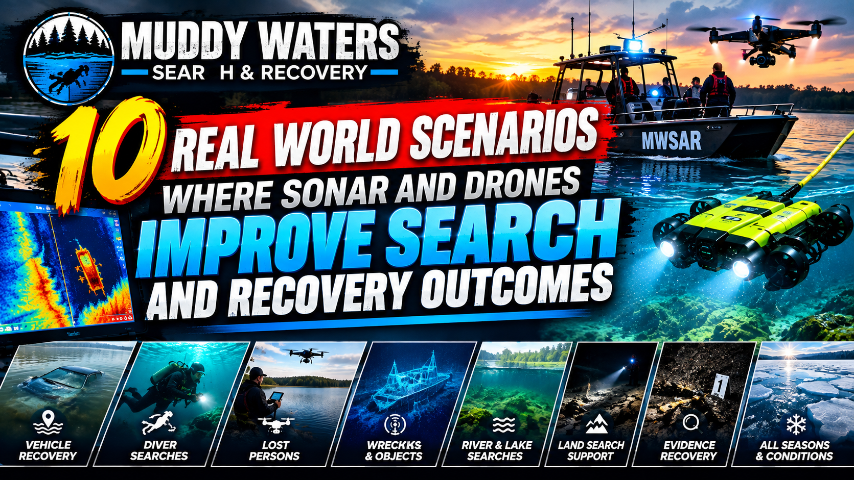
10 Real World Scenarios Where Sonar and Drones Improve Search and Recovery Outcomes
Search and recovery operations succeed or fail on speed, coverage, and safety. Traditional methods, boat crews, shoreline teams, and dive units remain essential, but they can be slowed by poor visibility, strong currents, hazardous debris, and the sheer size of waterways. Sonar and drones change the equation by letting teams search faster, document better, and reduce risk to responders.
In this article for DMCB MEDIA, you will find 10 real world scenarios that show how sonar and drones improve outcomes. Each scenario is written as a practical tip list you can adapt to your environment, whether you support fire rescue, law enforcement, emergency management, volunteer SAR, or private recovery teams. “Drones” here includes aerial drones for mapping and overwatch, and in some cases surface or underwater robotic platforms that carry sensors where people cannot safely go. “Sonar” includes side scan sonar, forward looking sonar, multibeam, and imaging sonar, depending on mission needs.
Across the scenarios, a consistent pattern emerges. Drones help you understand the scene, set boundaries, and coordinate resources. Sonar helps you “see” underwater, prioritize diver time, and turn large search areas into a small number of high probability targets. When both are used together, the result is faster localization, safer operations, and stronger documentation for investigations and after action reviews.
1. Vehicle submerged after a roadway departure into a river or canal
One of the most common and time critical water incidents is a vehicle that leaves the roadway and enters a river, canal, retention pond, or drainage basin. Even when witnesses provide a location, the vehicle can move quickly with current, sink at an angle, or be obscured by turbidity and vegetation.
How sonar and drones improve the outcome
- Aerial drone: Establishes an accurate last seen point by reviewing live video, photographing tire tracks, broken guardrail segments, and entry paths. It also identifies safe boat launch points, eddies, and debris hazards.
- Sonar: Rapidly confirms whether the vehicle is in the immediate area, then produces a target image that guides boat positioning and reduces blind diver searches.
Operational tips
- Use a drone to create a quick orthomosaic or at minimum a geo referenced photo set of both banks. This helps estimate how far the vehicle could drift based on current speed and time since entry.
- Run side scan sonar in overlapping lanes downstream of the last seen point, then switch to tighter lane spacing around any contacts.
- Mark contacts with GPS waypoints and physical markers when appropriate, for example weighted buoys, so that divers or a recovery boat can return precisely even if visibility worsens.
- If the waterway is narrow and cluttered, forward looking or imaging sonar can help the boat operator avoid hazards while keeping the sonar cone on the suspected object.
- Use the drone for overhead safety monitoring while a boat or divers operate, watching for floating hazards, rising water, or oncoming recreational traffic.
Why it matters
In many incidents, sonar reduces hours of risky searching to minutes of targeted verification. Drones reduce confusion at the scene, prevent unsafe launches, and document evidence for later investigation, including whether guardrails, signage, or road conditions contributed to the crash.
2. Missing person in a large lake, reservoir, or quarry with unclear entry point
Large still water environments challenge responders because there may be no confirmed entry point, the shoreline may be miles long, and the bottom may vary from shallow shelves to deep drops. Quarries add steep walls, submerged equipment, and sudden depth changes.
How sonar and drones improve the outcome
- Aerial drone: Quickly canvasses coves, docks, and beach access points for personal items, disturbed vegetation, footprints, clothing, or unattended gear. It also helps define search segments for ground teams.
- Sonar: Provides efficient coverage of deep water zones where divers cannot safely sweep for long periods. Multibeam can map steep contours, while side scan can highlight objects on flat bottoms.
Operational tips
- Use the drone first to identify likely access points, then translate those into prioritized sonar grids extending outward from each point.
- When winds are strong, use the drone to read surface conditions and plan sonar transects that minimize wave impacts on speed and heading control.
- In deep quarries, consider a mapping pass first. A simple bathymetry overview helps decide where sonar resolution matters most, such as ledges, benches, and drop offs.
- Use consistent naming for grid cells and waypoint labels so that dive supervisors, boat operators, and investigators stay synchronized.
- Capture and archive screen recordings from sonar and annotated drone footage to support case documentation and later review.
Why it matters
A drone accelerates the search for clues that narrow the underwater area. Sonar then turns “a lake” into a sequence of measurable lanes, improving coverage discipline and reducing the temptation to send divers into low probability areas just to “do something.”
3. Swiftwater river searches where visibility is near zero and currents are hazardous
Swiftwater incidents introduce moving targets, limited boat control, and significant risk to divers. Debris, strainers, and submerged hazards can trap personnel. In many rivers, visibility is effectively zero, eliminating traditional diver sweep effectiveness.
How sonar and drones improve the outcome
- Aerial drone: Provides real time current reading by observing surface patterns, standing waves, and eddy lines. It spots hazards and assists with downstream safety placement.
- Sonar: Locates anomalies such as a person, pack, or vehicle resting in eddies, behind boulders, or pinned near structures.
Operational tips
- Use the drone to map hazard zones and identify where a boat can safely hold station for sonar sweeps, such as behind islands or in slower inside bends.
- Run sonar passes in short segments with frequent repositioning. In swiftwater, long straight transects often fail because the boat cannot maintain consistent heading.
- Prioritize “collection points,” places where objects settle, like eddy fences, downstream of bends, bridge pilings, and low head dam tailwaters, while maintaining strict safety margins.
- Use the drone to coordinate downstream spotters and rescue assets before placing personnel near the waterline.
- When a contact is found, consider non diver verification first, such as pole cameras, grapples used under controlled conditions, or an underwater robot if available.
Why it matters
Swiftwater is where the combination of drone intelligence and sonar target detection can most directly reduce responder exposure. Instead of committing divers to blind searches, teams can make informed decisions about where it is safe and worthwhile to deploy people.
4. Flooded urban neighborhoods after storms, levee failures, or hurricanes
Flood operations combine large geographic areas, hidden hazards, displaced populations, and rapidly changing conditions. Streets become waterways filled with submerged cars, open manholes, fences, and sharp debris. The priority is life safety, but missing person calls and property recovery requests rise quickly.
How sonar and drones improve the outcome
- Aerial drone: Delivers broad situational awareness for incident command, including which routes are passable, where water is moving fastest, and where people may be stranded on roofs or in attics.
- Sonar: Helps boat crews avoid underwater hazards and can identify submerged vehicles or large debris fields that block navigation corridors or hide victims.
Operational tips
- Use drones early to build a live map of flood extent, then keep a rolling update schedule. Even a two hour old picture can be wrong after a major breach.
- Assign a drone operator to support boat task forces, not only to search for people but to guide them away from underwater hazards identified by sonar or surface signs.
- If using sonar to scan streets, treat them like narrow channels. Slow down, use tighter range settings, and maintain awareness of overhead hazards such as power lines for both boats and drones.
- Capture imagery for later damage assessment and investigations. Drone data often becomes critical for documenting initial conditions before cleanup alters the scene.
- Maintain clear airspace coordination. Flood responses often include helicopters and multiple agencies. Establish altitude blocks and communication protocols.
Why it matters
In floods, drones provide the big picture and sonar provides the unseen hazards beneath the surface. Together they keep crews moving efficiently through a dangerous environment while increasing the chance of locating stranded or missing people.
5. Bridge incidents, pier collapses, and structure related submersion events
When incidents occur near bridges, docks, piers, or seawalls, the underwater environment becomes complex. There may be rebar, pilings, cables, or collapsed debris. Currents often accelerate around pilings, creating scour holes and unpredictable flow.
How sonar and drones improve the outcome
- Aerial drone: Inspects the above water structure for instability, identifies falling hazards, and helps determine safe zones for boats and divers.
- Sonar: Images the underwater structure, including missing sections, submerged debris piles, and potential entrapment points where a victim or evidence may be located.
Operational tips
- Fly the drone to inspect the structure before putting any team directly beneath it. Look for spalling concrete, bent beams, and hanging material.
- Use sonar to identify scour holes. These depressions can trap vehicles and are often deeper than expected near pilings.
- In dense piling fields, run shorter sonar ranges and make multiple passes from different angles. A single perspective can hide targets behind acoustic shadows.
- Share sonar snapshots with dive supervisors. Divers should know where the hard hazards are before entering the water.
- If the incident involves a crime scene, use the drone to document access points and the immediate area for trace evidence preservation, including footprints and discarded items.
Why it matters
Structure related incidents are where blind diving becomes extremely risky. Sonar helps identify the most dangerous entanglement zones and the most likely deposition areas. Drones help keep everyone out from under unstable structures while still gathering actionable intelligence.
6. Night operations and low visibility weather where shore teams cannot see hazards
Many searches begin after dark, during rain, fog, or snow. Low visibility increases the risk of shoreline slips, boat strikes, and missed clues. It also complicates coordination, because commanders cannot easily confirm where teams are operating.
How sonar and drones improve the outcome
- Aerial drone: Uses low light cameras, spotlights, and thermal sensors when appropriate to locate people on shorelines, sandbars, or in shallow water. It can also provide overwatch for responder safety.
- Sonar: Performs underwater search independent of light. Imaging sonar can detect a body, vehicle, or large object even when the surface appears calm and empty.
Operational tips
- Use the drone to establish a lit, safe working area for shoreline teams with vehicle headlights and portable lights. Coordinate lighting to avoid blinding pilots or boat operators.
- For thermal use, remember limitations. Water often masks heat signatures. Thermal is best for people on land, on boats, or partially out of water.
- Use sonar to maintain progress when visibility prevents effective visual searches. Define a time boxed sonar plan so the night shift produces measurable coverage.
- Coordinate deconfliction with other aircraft. Night scenes may attract news helicopters or medical flights, so maintain an airspace plan.
- Document everything. Night operations can create disputes later about what was searched. Drone video and sonar logs protect the team and clarify decisions.
Why it matters
At night, teams can waste hours repeating the same shoreline segments without realizing it. A drone provides positioning and overwatch. Sonar provides a way to continue underwater search with consistent coverage, reducing fatigue and uncertainty.
7. Underwater evidence recovery for law enforcement, including firearms, safes, and discarded electronics
Evidence recovery demands precision and documentation. Objects may be small, partially buried, or mixed with trash. The environment might be a retention pond near a crime scene, a canal beside a roadway, or a river under a bridge. The scene may also require chain of custody and defensible search methods.
How sonar and drones improve the outcome
- Aerial drone: Documents the scene, access routes, and potential discard paths. It can also identify disturbed shoreline areas and generate maps for case files.
- Sonar: Locates metal objects indirectly by identifying anomalies, and directly when items are large enough or have distinct shapes. Sonar also helps focus magnetometer sweeps or diver time.
Operational tips
- Start with a drone mapping pass to establish a scaled scene overview. Include landmarks, entry points, and any signage or barriers that may later change.
- Use a systematic sonar grid with documented lane spacing and speed. This supports later testimony that the search was thorough and repeatable.
- Expect small evidence to be challenging for sonar alone. Combine tools, for example sonar to find larger debris piles, then magnetometer and targeted diver probing to find smaller metallic items inside those piles.
- Use geo referenced notes. When an item is recovered, record GPS position, water depth, time, and who handled it, then tie those notes to drone imagery.
- Preserve digital evidence properly. Archive original drone files and sonar logs with hash values when possible, and maintain a clear chain of custody for media.
Why it matters
Evidence cases can hinge on search credibility. Drones provide visual documentation and context. Sonar provides a structured underwater search method that can be explained and defended, while minimizing unnecessary disturbance of the scene.
8. Boat and aircraft wreckage localization after an impact and sinking
When a small aircraft impacts water or a boat sinks in deep or cold conditions, the debris field can spread. Witness statements may be uncertain, and weather can move floating debris far from the main wreckage. The primary wreck can be in deep water beyond safe diver limits.
How sonar and drones improve the outcome
- Aerial drone: Searches for floating debris, fuel sheen patterns, and survivors. It can also guide vessels to debris clusters and document the distribution for investigators.
- Sonar: Locates the main wreckage on the bottom, maps the debris field, and supports planning for lift operations, remote vehicle inspection, or diver missions when safe.
Operational tips
- Use a drone to map floating debris extent and direction of travel. Treat this as a drift study that informs where to start sonar work upwind or upstream.
- Conduct sonar in expanding boxes or parallel tracks based on likely sinking location, then extend coverage toward where heavier components would settle, such as engine blocks.
- When a contact is located, run multiple sonar passes at different angles to confirm shape and size and to identify any snagging hazards for recovery lines.
- Use the drone to monitor vessels conducting recovery. It can help keep non involved boats away and record operations for safety and investigation.
- Plan for data handoff to investigative agencies. Sonar imagery paired with drone mapping creates a clearer picture of the wreck site and debris field.
Why it matters
Wreckage recovery can become prolonged, expensive, and dangerous. Drones reduce the time to find floating indicators and refine the search area. Sonar provides the primary means to localize the wreck and support a controlled, well documented recovery plan.
9. Ice covered water and cold weather operations where access is limited
Ice incidents create a uniquely dangerous environment. Ice thickness varies, currents under ice can weaken it, and reaching a target can put rescuers at risk of breaking through. Even after an initial rescue phase, recovery operations may continue under ice cover.
How sonar and drones improve the outcome
- Aerial drone: Evaluates ice conditions visually, identifies cracks and pressure ridges, and helps establish safe access routes for teams and equipment.
- Sonar: Supports under ice searching from openings, from the shoreline, or from a safe platform. Imaging sonar can be used to scan under the ice without requiring divers to enter immediately.
Operational tips
- Use the drone to survey the ice sheet for cracks, thin areas, and open leads. Mark safe routes for responders and keep the route updated as conditions change.
- Coordinate with ice rescue specialists on where to create an access hole if needed. Place holes where currents are minimal and where equipment can be anchored safely.
- Use sonar to scan radiating outward from the access point. Keep meticulous notes because under ice orientation is easy to lose, especially in low light.
- For long duration missions, rotate crews and monitor for cold stress. Drones can reduce the number of personnel exposed by providing persistent overwatch.
- Document the ice environment with drone video for later review and training. Ice conditions change quickly, and footage helps refine future response plans.
Why it matters
Under ice, diver deployment is complex and high risk. Drones help teams choose safer access and staging locations. Sonar helps confirm targets and reduces unnecessary under ice exposure, which improves both safety and speed.
10. Post disaster debris fields in waterways, including tornadoes, landslides, and industrial accidents
After major disasters, waterways can become clogged with building materials, vehicles, household contents, and hazardous substances. Victims, evidence, and critical items may be trapped in debris mats. The water itself may be contaminated, increasing risk to personnel.
How sonar and drones improve the outcome
- Aerial drone: Maps debris fields, identifies access corridors, documents hazardous materials indicators, and supports command decisions about where to deploy limited resources.
- Sonar: Detects submerged debris piles and voids, identifies heavier objects that sank, and helps determine where the bottom has changed due to scouring or sediment deposition.
Operational tips
- Use drones to rapidly classify debris zones. Separate areas into categories, such as light surface debris, heavy mixed debris, and suspected hazardous areas, then plan sonar and boat work accordingly.
- Pair drone mapping with shoreline GPS control points when possible. Accurate mapping improves coordination between agencies and contractors.
- Use sonar to find “hard targets” hidden under debris mats, such as vehicles, safes, and appliances, which may indicate where other items accumulated.
- Assume contamination until proven otherwise. Use drones to reduce unnecessary personnel entry, and use sonar to limit dive time to essential, high probability tasks.
- Maintain a strong documentation workflow. In disaster conditions, scenes change daily. Drone imagery and sonar records preserve what was present when decisions were made.
Why it matters
Debris field operations often overwhelm traditional search methods. Drones speed up area assessment and help commanders prioritize. Sonar reveals what is hidden beneath floating mats and muddy water, enabling targeted, safer recovery actions.
Practical integration tips that apply to all 10 scenarios
Regardless of the incident type, successful sonar and drone integration depends on coordination, consistent workflows, and clear safety practices. Consider these cross cutting tips when building or improving your program.
- Build a shared incident map: Use one map product that combines drone observations, sonar waypoints, and team assignments. Confusion about coordinates is a common failure point.
- Standardize terminology: Agree on what “contact,” “target,” “confirm,” and “clear” mean, and write it into your SOPs.
- Log everything: Time, tracklines, lane spacing, and decision points matter. Logs support after action learning and legal defensibility.
- Train as a combined team: Drone pilots, boat operators, sonar techs, and dive leaders should practice together so that handoffs are smooth.
- Plan for communications: Waterways, bridges, and urban canyons can degrade signals. Establish primary and backup channels and confirm them before launch.
- Protect responder safety: Use drone overwatch to reduce shoreline exposure and sonar to minimize blind diver operations, especially in moving water and debris heavy conditions.
Closing perspective
Sonar and drones do not replace experienced responders, they amplify them. In real world operations, the biggest gains come from using drones to define and manage the scene, then using sonar to turn underwater uncertainty into actionable targets. Whether you are locating a submerged vehicle, mapping a debris field, or conducting an evidence recovery, the combined approach improves speed, safety, and documentation.
If your organization is starting from scratch, begin with simple, repeatable workflows, basic grid searches, clear logs, and joint training. Over time, you can add advanced sensors and automation. The goal is consistent outcomes and safer missions, not just more technology. For more public safety technology and operational planning content, follow DMCB MEDIA.